


Meg Bisson

Pauline88
User

Length
9.2 km

Max alt
1565 m

Uphill gradient
617 m
Km-Effort
16.7 km

Min alt
979 m

Downhill gradient
384 m
Boucle
No
Creation date :
2021-08-11 12:41:36.0
Updated on :
2021-08-11 15:39:29.254
2h55
Difficulty : Unknown

FREE GPS app for hiking
 SityTrail
IGN / Geographical institutes
SityTrail Plus
The world is yours!
About
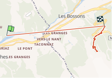
Trail Walking of 9.2 km to be discovered at Auvergne-Rhône-Alpes, Upper Savoy, Les Houches. This trail is proposed by Pauline88.
Positioning
Country:
France
Region :
Auvergne-Rhône-Alpes
Department/Province :
Upper Savoy
Municipality :
Les Houches
Location:
Unknown
Start:(Dec)
Start:(UTM)
329816 ; 5085229 (32T) N.
Comments